Click TIDES Tab Above For List of 2023 – 2024 TIDE TABLES
Tides Differ By Location
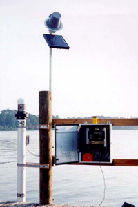
NOAA provides information about tides (via the internet) to the public for free. NOAA is always expanding their installation of solar powered tide monitoring stations. These stations electronically monitor tide data all over Oregon and Washington. Years ago these new solar powered stations were not available, so we had far fewer locations to retrieve data from.
The Columbia River inland monitored by 20 different monitoring stations. There are around 30 different monitoring stations within a 10-mile radius of the Columbia River’s mouth. There can be a difference in tide monitoring data within distances of less than a few miles apart. Pick the wrong tide data monitoring station information and you could show up for clamming at the wrong time. For example, if you pick the 12th Avenue Bridge monitoring station in Seaside it can differ from Seaside’s beach tides significantly.
What I’ve Used For Years
For years, I have used the NOAA Monitoring Station at the Columbia River mouths North Jetty, to get Seaside, Oregon and Long Beach Washington’s tides. Even though, this is at Washington State’s side of the Columbia. The North Jetty monitoring station has location factors that make it the closest to reality for Seaside, Oregon and Long Beach, Washington tides. Good for both locations! But depending on weather conditions and other factors, this can be fifteen minutes off in one or the other location. Sometimes more than a 30 minutes’ difference from one beach to another. However, this is about as good as you can get and mirrors most tide books you can buy in Seaside, Oregon or Long Beach, Washington.
If you’re going to be anywhere else in Oregon, or the Puget Sound area. If you don’t trust the information you’re getting on the internet. Sometimes I will call a local sporting goods store to be sure (even hotels will carry tide books in many locations and are happy to be as helpful as possible).
Open Razor Clamming Tides in Washington Frequently Change
The Washington Department of Fish and Wildlife schedules Razor Clamming dates a few weeks or a few months in advance. But these are generally tentative and can change. So, a few days prior to a dig biotoxin tests are done again. Consequently, a scheduled opening can change the day of a planned dig. Be advised, this is not that much of an inconvenience for locals but can make things exceedingly difficult for visitors.
Tide Tables Disclaimer:
Recent weather has an impact on tide predictions, when clamming always arrive one to two hours early. Tide data is based upon the latest information available from the National Oceanic and Atmospheric Administration (NOAA). Most importantly, there are many NOAA Tides stations available throughout Oregon and Washington. However, the closet available bay or beach tide station has been used for each location. Therefore, location data can vary depending on which tide station is used. Although tide data from NOAA are believed to be reliable, there is no warranty expressed or implied. This includes accuracy, adequacy, completeness, legality, reliability, or usefulness of any information.